Pages

20 November 2013

DNA TESTING

So if you know someone who has an Ancestry account that gets the offer of $79.00 DNA test you can have them purchase it for you at that price, well plus shipping.

So you can start getting your cousin connections.  Which can lead you to earthly relationships, break down a brick wall, or more info. to help you find that next piece of the family puzzle.

So I did the test myself, since my dad had a bunch of us tested for the Autosomal DNA.  So we can figure out moms ethnicity.  Was she really  what the paper genealogy shows?


27 September 2013

Michigan Islands: Lake Huron - Mackinac Island


 The most famous of Islands in Michigan

Mackinac Island


 A historic event in medical discovery:

Alexis St. Martin

From Wikipedia, the free encyclopedia


Alexis St. Martin, age 67[1]
Alexis St. Martin (April 18, 1802[2] – June 24, 1880) was a Canadian voyageur who is known for his part in experiments on digestion in humans, conducted by the American Army physician William Beaumont between 1822 and 1833.

Work with Beaumont

From Beaumont's Experiments and Observations on the Gastric Juice and the Physiology of Digestion, 1833 (p. 27)
On June 6, 1822 Alexis St. Martin, at the fur trading post on Mackinac Island, was accidentally shot with a musket at close range. The charge of the musket shot left a hole through his side that healed to form a fistula aperture into his stomach.[3][4]
William Beaumont, a US Army surgeon stationed at a nearby army post, treated the wound. Although St. Martin was a healthy 20-year-old, he was not expected to recover due to the severity of his wound. Beaumont explains in a later paper that the shot blew off fragments of St. Martin's muscles and broke a few of his ribs. After bleeding him and giving him a cathartic, Beaumont marked St. Martin's progress. For the next 17 days, all food he ate re-emerged from his new gastric fistula. Finally after 17 days, the food began to stay in St. Martin's stomach and his bowels began to return to their natural functions. When the wound healed itself, the edge of the hole in the stomach had attached itself to the edge of the hole in the skin, creating a permanent gastric fistula. There was very little scientific understanding of digestion at the time and Beaumont recognized the opportunity he had in St. Martin - he could literally watch the processes of digestion by dangling food on a string into St. Martin's stomach, then later pulling it out to observe to what extent it had been digested. Beaumont continued to experiment on St. Martin off and on until 1833.
Alexis St. Martin allowed the experiments to be conducted, not as an act to repay Beaumont for keeping him alive, but rather because Beaumont had the illiterate St. Martin sign a contract to work as a servant. Beaumont recalls the chores St. Martin did: "During this time, in the intervals of experimenting, he performed all the duties of a common servant, chopping wood, carrying burthens, etc. with little or no suffering or inconvenience from his wound." Although these chores were not bothersome, some of the experiments were painful to St. Martin, for example when Beaumont had placed sacks of food in the stomach, Beaumont noted: “the boy complained of some pain and uneasiness at the breast.” Other symptoms St. Martin felt during experiments were a sense of weight and distress at the scrobiculus cordis and slight vertigo and dimness of vision.

After the experiments

Alexis St. Martin, age 81 (2 years after death at 79)[5]
Beaumont published the account of his experiments in 1838 as Experiments and Observations on the Gastric Juice, and the Physiology of Digestion. He and St. Martin parted ways, with Beaumont eventually going to St. Louis, Missouri, and St. Martin to his home in Quebec, Canada. Off and on for the next twenty years, Beaumont tried to get St. Martin to move to St. Louis, but the move never occurred. Beaumont died in 1853 as a result of slipping on ice-covered steps.[6]
When Alexis St. Martin died at St-Thomas de Joliette, Quebec, in 1880 his family delayed his burial until the body began to decompose in order to prevent his “resurrection” by medical men, some of whom wished to perform an autopsy. The eminent physician Sir William Osler took a great interest in retracing the details of this early incident in the history of gastric physiology and published his research in the form of a well-known essay entitled "A Backwoods Physiologist." He also attempted to have the famous stomach placed in Army Medical Museum in Washington, DC.

Media

  • The story of Alexis St. Martin's life as Beaumont's human guinea pig was featured in "To Search for Truth", a 1956 episode of Medic.
  • Beaumont's experiments on St. Martin were featured in a 2012 episode of Radiolab, which aired in on 2 April.[7]

References

  1. Myer, Jesse S. (1912). Life and Letters of Dr. William Beaumont. C. V. Mosby Company (St. Louis). p. 282.
  2. There has been on-going confusion of brothers with the same name. Alexis of this article had an older brother born in 1794 who died in January 1802. Alexis the voyageur was actually born in April, 1802 in Berthierville, Quebec and named for his brother who had died several months before. from Ancestry.com. "Alexis Bidaguin dit St. Martin baptism: Quebec Vital and Church Records (Drouin Collection), 1621-1967: Berthierville: 1802". Retrieved 2009-06-29.
  3.  Beaumont, William (1833). Experiments and Observations on the Gastric Juice and the Physiology of Digestion. Edinburgh: Maclachlan and Stewart.
  4. HarrĂ©, R. (1981). Great Scientific Experiments. Phaidon (Oxford). pp. 39–47. ISBN 0-7148-2096-2.
  5. Myer, Jesse S. (1912). Life and Letters of Dr. William Beaumont. C. V. Mosby Company (St. Louis). p. 298.
  6.  Myer, Jesse S. (1912). Life and Letters of Dr. William Beaumont. C. V. Mosby Company (St. Louis). p. 296.
  7.  http://www.radiolab.org/2012/apr/02/holey-cow/ Radiolab: "Guts: Holey Cow." WNYC, April 2, 2012. Retrieved 2012-09-30.

25 September 2013

Help Other And Learn While Doing It

Have you heard of FREE RICE yet?

Its where you can test your self on many aspects of knowledge.  For every correct answer you are giving away 10 grains of rice.  Answer lots correct give away alot.

Go ahead give some rice away today expand your knowledge.  Have Fun while doing good.


24 September 2013

Genealogy and TV shows


What a wonder it is that Television is bringing us Genealogy/Family History to our homes.

I think it really must be opening 
up family discussions. 
 Most definitely have folks 
questioning more about themselves 
and where they come from.

When you do family history how quickly you come to realize just how often our ancestors moved around. 

Myself both my mom and dad only moved to the town they raised us in.  Neither of them born there.  While I will say that even I did not come from the city I live in. 17 years we have lived in our adopted city.   

So when you can't find that ancestor on the next census in the same town/city you will have to broden your horizons and look else where.  

Genealogy Roadshow on PBS

Way Cool Genealogy Roadshow

You can watch it at on your own time at:


video.pbs.org/video/2365079236/
copy and paste it into your browser watch it and enjoy the stories and myths come to life 
or be put to rest.


It's a such a delight to watch as 
Josh Taylor & Kenyatta Berry  help answer burning questions.  Who knows you might find info. break down a brick wall watching this episode.


19 September 2013

Caerlaverock Castle, Scotland

I found a Lovely Web Site regarding Caerlaverock Castle and its History.

Caerlaverock Castle is perhaps more readily identified with Clan Maxwell than any other historical site. Located just a few miles Southeast of Dumfries, Scotland, Caerlaverock was owned by Maxwells and their descendants from the time when the lands were first acquired by John de Muccuswell early in the 13th century. 
In the later Middle Ages, it was the Maxwell stronghold when the family served as Wardens of the West March.

 Over the years it was besieged five times, changed hands time and again, and was at least once almost totally destroyed. Yet today its ruins tell of its fascinating past and epitomize the medieval stronghold.
The first castle on the site was built around the 1220s, an earthwork fortification surrounded by a moat in the marshes to the south of the present building. That very basic defensive structure was replaced by a substantial castle, built by Sir Herbert de Maxwell around 1277. It was that structure which was besieged by King Edward I in 1300, the castle’s most famous event.
Scottish Castles, Scotland History, Scotland, Castle, Heritage The castle drawbridge and moat
The siege of 1300 became famous mainly through an epic French poem which told:
“Caerlaverock was so strong a castle that it feared no siege before the King came there, for it would never have had to surrender, provided that it was well supplied, when the need arose, with men, engines and provisions.In shape it was like a shield, for it had but three sides round it, with a tower at each corner, but one of them was a double one, so high, so long, and so wide, that the gate was underneath it, well made and strong, with a drawbridge and a sufficiency of other defences. And it had good walls, and good ditches filled right up to the brim with water. And I think you will never see a fore finely situated castle, for on the one side can be seen the Irish Sea, towards the west, and to the north the fair moorland, surrounded by an arm of the sea, so that no creature born can approach it on two sides, without putting himself in danger of the sea. On the south side it is not easy, for there are many places difficult to get through because of woods and marshes and ditches hollowed out by sea where it meets the river.”
The old account of the castle’s construction could just as easily be a description of the present structure. And there are still in the castle some remains of that structure which stood in 1300. But most of the “second” Caerlaverock was destroyed about 1312, when Sir Eustace Maxwell, having declared for Robert Bruce, king of the Scots, was besieged by Edward II’s forces and, in keeping with Bruce’s policy of denying the enemy any stronghold which might be useful to him later, demolished Caerlaverock when forced to abandon it.


When the castle was rebuilt is not known, but history tells that Herbert of Maxwell delivered hostages at the castle after submitting to Edward III in 1347. In return, Maxwell received letters of protection for himself, his men, and the castle.

Scottish Castles, Scotland History, Scotland, Castle, Heritage
In 1355 or 1356, Roger Kirkpatrick brought all of Nithsdale under the Scottish Crown once more. He captured Caerlaverock and, according to a chronicle of the time, reduced it to the ground; however, the same chronicle contains an entry from the following year saying that the same Roger was killed “at the castle of Caerlaverock. So it is hard to tell specifically when the structure was again destroyed, but signs of a partial destruction are still evident in today’s structure.
Evidence suggests that the next rebuilding of the castle started about 1370. Other additions and changes were made through the years, such as the completion of the bartizan of Caerlaverock by Robert, second Lord Maxwell, who succeeded his father Herbert, the first Lord, in 1452 and lived until 1488.
While the mid-1400s saw the construction of manor houses by the Lords in England, the relative insecurity of the Scottish countryside led to construction of tower houses by the Scottish Lords. The gatehouse at Caerlaverock served this purpose, with a great chamber on the first floor and rooms on the second floor and in the towers.
By the mid-15th century, other buildings rose in the courtyard containing fireplaces and windows. These provided accommodations for guest, while Lord Maxwell’s rooms were closer to the entrance where, when needed, he could command the castle’s defense.
In the turbulent 16th century, the castle changed hands several times between the English and the Scots. Although James V was a guest at the castle in 1542, Caerlaverock was surrendered by negotiation to Henry VIII three years later. It was later besieged and recovered by the Scots, only to be taken in 1570 by the English under the Earl of Sussex who “threw down” the castle. That damage must have been relatively slight, however, because Lord Maxwell was recorded as making “great fortifications” in 1593, having “many men working at his house.”
The 17th century saw even more construction at the castle, with Robert Maxwell, first Earl of Nithsdale, erecting buildings designed for comfort rather than for military fortification. The “Nithsdale Apartments,” as they are now known, are dated by the inscription of “1634” on a window-head of the Renaissance style buildings which are embellished with much fine detail. This was to be the Maxwells’ fine house, but it was not to be enjoyed very long.
Scottish Castles, Scotland History, Scotland, Castle, Heritage 
 Nithsdale apartments inside Caerlaverock Castle


When the truce broke down between King Charles I and the Covenanters in 1640, the king warned the Earl of Nithsdale, who was one of the king’s staunch supporters, to “look to himself.” Accordingly, the Earl gathered 200 soldiers in the castle and withstood a siege for 13 weeks before finally, with the king’s permission, capitulating.
It was following that loss that Caerlaverock was partially destroyed with the intent of rendering it unfit either as a fortress or a residence. The castle has remained a ruin ever since, passing by inheritance through the family of Herries to the dukes of Norfolk. The 16th Duke of Norfolk placed it in the hands of the state in 1946, and it is operated today by Historic Scotland, a government agency which maintains many of Scotland’s historic properties.
Scottish Castles, Scotland History, Scotland, Castle, Heritage Archeological dig ongoing at Caerlaverock
For updated information on the Archeological Dig at Caerlaverock, point your browser to: www.suat.demon.co.uk/caerlaverock
For operating hours and directions to Caerlaverock, contact Historic Scotland at: www.historic-scotland.gov.uk


28 August 2013

Genealogy Quotes #4


"Why waste your money looking 
up your family tree?
Just go into politics, and your opponents 
will do it for you."

-Mark Twain-

27 August 2013

Michigan Islands #2

Have you ever been to any of these islands? 
Do you have ancestors who lived on any of these Islands?

South Manitou Island

South Manitou Island, Michigan, MI, Michigan Islands, Family history, genealogy, family fun, trips to michigan


South Manitou Island, Michigan, MI, Michigan Islands, Family history, genealogy, family fun, trips to michigan

All photos found on google images


North Manitou Island


North Manitou Island, Michigan, MI, Michigan Islands, Family history, genealogy, family fun, trips to michigan
found on Wikipedia

North Manitou Island, Michigan, MI, Michigan Islands, Family history, genealogy, family fun, trips to michigan


26 August 2013

Lake Michigan Islands


The islands in the Beaver Island archipelago include, in rough order of size:


Washington Island part of Wisconsin


Genealogy Quotes series #3

“These stories will probably be like a large ball of string: made up of many small strings too short to use and too long to throw away.”  

-Vera Mae Slone-

25 August 2013

Genealogy Quotes series#2

"In all of us there is a hunger, marrow-deep, to know our heritage - to know who we are and where we have come from. Without this enriching knowledge, there is a hollow yearning. No matter what our attainments in life, there is still a vacuum, an emptiness and the most disquieting loneliness."
-- Alex Haley

Genealogy Quotes series

"She calls to me from long ago; through sunlit skies; through drifts of snow. In clouds that dance upon the sea, I call to her, and she to me. 

So real was she. She laughed; she cried. She loved; she lost. She lived; she died. She hoped and dreamed; so real was she. She lived a life that I may be. 

The blood through which my veins does flow is the same as her's from long ago. So it will be that when I'm gone in an unborn child it will flow on. 

I'll live my life and when it's done I'll live again in those to come. For I'm a bridge from she to me; from those that were, to those to be."

-- Darlene Caryl-Stevens

18 August 2013

46 Chromosomes Thats what each of us are made from!

When Sperm penetrates the egg we have begun.  What we look like its all in the genes.  
Tall, short, dark, fair, pear, board or apple shaped.
Smaller odds then the roll of the dice.  

23 Chromosomes From Mom-Through Oogensis: 
 Science, Egg and Sperm, oogenesis, baby making, offspring 46 to 23 chromosones, Science


23 Chromosomes From Dad-Through Spermatogenesis:
Science, Egg and Sperm, Spermatogenesis, baby making, offspring 46 to 23 chromosones, Science


Its amazing that what we get.  


Fertilation Science, Science, Egg and Sperm, Human baby, baby made, Baby will come from union


So the Sperm brings its own individual 23 chromos. with it to the egg. The egg has 23 chromos of its own.

No 2 sperm carries different 23 chromos  as another sperm.  Same goes for the Egg each egg has a different lineup of 23 chromosomes.

Thats why we can all look so different then our siblings  then maybe all look so much alike.

13 August 2013

Name Origins


Name Origins
by Julie Helen Otto, Genealogist Of NEHGS newletter
Women's names, Asenath, Old Family photos, Family History, genealogy
Asenath Collins (1839-1870)
found at:  
http://freepages.family.rootsweb.ancestry.com/~garyscottcollins/
SENA (f): Often a nickname for ASENATH (or for any other name with middle or ending element -sen- [e.g. POLYXENA]. ASENATH is Old Testament Biblical, originally Egyptian ("And Pharaoh called Joseph's name Zaphnath-paaneah; and he gave him to wife Asenath, daughter of Potipherah, priest of On --" Gen. 41:45), while POLYXENA (not mentioned by Homer) was a Trojan princess, betrothed or married to Achilles (accounts differ) and sacrificed by the victorious Greeks on his tomb "to appease his shade." (Clarence L. Barnhart, William D. Halsey et al., The New Century Cyclopedia of Names, 3 vols. [1954], 3:3218). Here the specific meaning of a name has given way to phonetic convenience, if you will. In such cases it may be important to seek names in other forms: a woman may be Asenath in her birth record, Sena in her marriage record -- or Sena in her birth record and Polly X. at marriage.

Sena Luddington, daughter of Titus and Merriam Luddington, was born July 20, 1773, in Wallingford, New Haven County, Connecticut. (Connecticut Vital Records to 1870, The Barbour Collection, AmericanAncestors.org.) In his 1815 will, Joseph Van Falkenburgh of Sharon, Schoharie County, New York, gave $200 to his daughter, Sena Van Falkenburgh. (Abstracts of Wills, Admins. and Guardianships in NY State, 1787-1835, AmericanAncestors.org.)

20 July 2013

Ancestors and Copper Mining

Here is a slide show I found on you-tube of what these mines look like in recent years.

http://www.youtube.com/watch?v=sCc74k6bHGs


Ancestors and Copper Mining.
Are you like me and have Ancestors that came to Michigan for work in the Copper Mines?
I went to Wikipedia to find out even more.  You too can look into more about Copper Mining.  Copper Mining is still a viable business in the USA.  Read more about it.

“Copper mining in Michigan
From Wikipedia, the free encyclopedia

Geology

http://bits.wikimedia.org/static-1.20wmf7/skins/common/images/magnify-clip.png
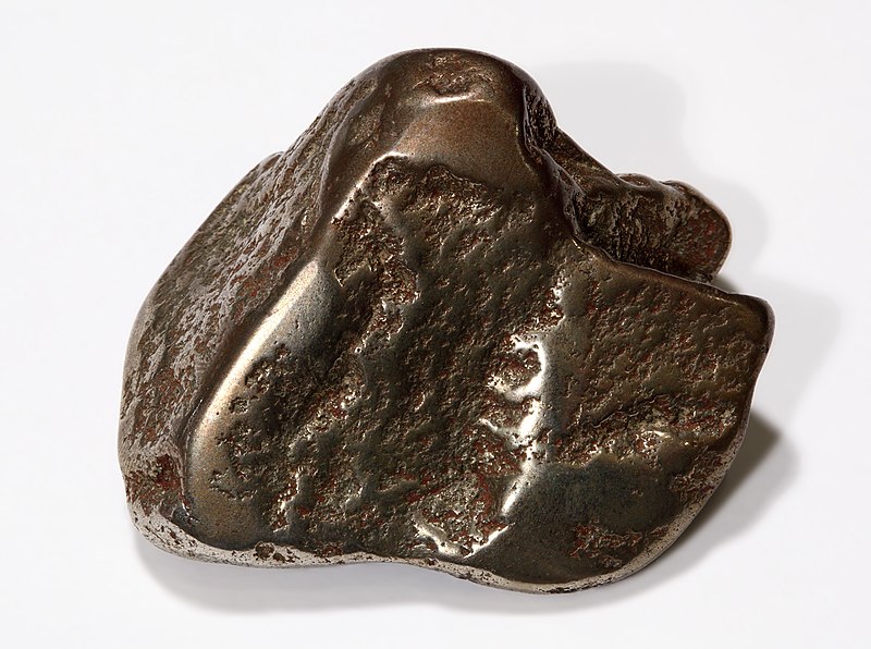
Mohawkite nugget, a mixture of domeykite, algodonite and native copper

Within the state of Michigan, copper is found almost exclusively in the western portion of the Upper Peninsula, in an area known as the Copper Country. The Copper Country is highly unusual among copper-mining districts, because copper is predominantly found in the form of pure copper metal (native copper) rather than the copper oxides or copper sulfides that form the copper ore at almost every other copper-mining district.Precambrian age, in a thick sequence of northwest-dipping sandstones, conglomerates, ash beds, and flood basalts associated with the Keweenawan Rift.
copper, copper mining in michigan, mining in michigan, copper mining, Quincy Mines, Keenewa, Calumet
The copper deposits occur in rocks of
Although native copper was the dominant ore mineral, chalcocite (copper sulfide) was sometimes present, and, especially in the Mohawk mine, copper arsenide minerals such as mohawkite and domeykite. Gangue minerals included calcite, quartz, epidote, chlorite, and various zeolites. A number of copper mines also contained a notable amount of silver, both in native form and naturally alloyed with the copper. Halfbreed is the term for an ore sample that contains the pure copper and pure silver in the same piece of rock; it is only found in the native copper deposits of the Upper Peninsula of Michigan.[1


While it originated thousands of years earlier, copper mining in Michigan became an important industry in the 19th and early 20th centuries. Its rise marked the start of copper mining as a major industry in the United States.

Native American mining

Native Americans were the first to mine and work the copper of Lake Superior and the Keweenaw Peninsula of northern Michigan between 5000 BCE and 1200 BCE. The natives used this copper to produce tools. Archaeological expeditions in the Keweenaw Peninsula and Isle Royale revealed the existence of copper producing pits and hammering stones which were used to work the copper.[2] Fringe writers have suggested that as much as 1.5 billion pounds of copper was extracted during this period, but archaeologists consider such high figures as "ill-constructed estimates" and that the actual figure is unknown.[3]
By the time the first European explorers arrived, the area was the home of the Chippewa people, who did not mine copper. According to Chippewa traditions, they had much earlier supplanted the original miners. The first written account of copper in Michigan was given by French missionary Claude Allouez in 1667. He noted that Indians of the Lake Superior region prized copper nuggets that they found there.[4] Indians guided missionary Claude Dablon to the Ontonagon Boulder, a 1.5-ton piece of native copper along the Ontonagon River. When American prospectors arrived in the 1840s, pieces of copper were found in streams or on the ground. The copper pits abandoned by Native Americans led early miners to most of the first successful mines.

Modern mining industry

http://bits.wikimedia.org/static-1.20wmf7/skins/common/images/magnify-clip.png
Miners at the Tamarack Mine in the Copper Country of Michigan in 1905.
copper, copper mining in michigan, mining in michigan, copper mining, Quincy Mines, Keenewa, Calumet, man who copper mined    

http://bits.wikimedia.org/static-1.20wmf7/skins/common/images/magnify-clip.png
Copper being loaded onto a steamer in Houghton, Michigan, c1905
The Michigan State Geologist Douglass Houghton (later to become mayor of Detroit) reported on the copper deposits in 1841, which quickly began a rush of prospectors. Mining took place along a belt that stretched about 100 miles southwest to northeast through Ontonagon, Houghton, and Keweenaw counties.[5] Isle Royale, on the north side of Lake Superior, was extensively explored, and a smelter built, but no mining of any importance took place there.[6] Some copper mineralization was found in Keweenawan rocks farther southwest in Douglas County, Wisconsin, but no successful mines were developed there.
Copper mining in the Upper Peninsula boomed, and from 1845 until 1887 (when it was exceeded by Butte, Montana) the Michigan Copper Country was the nation's leading producer of copper. In most years from 1850 through 1881, Michigan produced more than three-quarters of the nation's copper, and in 1869 produced more than 95% of the country's copper.[7]

Fissure veins

Commercial production began in 1844 at the Phoenix mine. Most early miners began with little knowledge or planning, and few mines ever saw production, much less profit. The first successful copper mine, the Cliff mine, began operations in 1845, and many others quickly followed. These first mines worked copper-filled fissure veins that cut across stratigraphic layers.
Although the copper-mining region stretched about 100 miles from northeast to southwest, the most productive early mines, working fissure veins, were those at the north end in Keweenaw County (such as the Central, Cliff, and Phoenix mines), or at the south end in Ontonagon County (such as the Minesota Mine).
In Keweenaw County, the fissure lodes were nearly vertical mineralized zones with strike nearly perpendicular to that of the enclosing basalts and conglomerates. In Ontanogan county, by contrast, the fissures had strikes nearly parallel to, and dips slightly steeper than, the surrounding beds.
The miners sometimes found masses of native copper up to hundreds of tons. To extract a single mass of copper, miners could spend months chiseling it into pieces small enough to hoist out of the mine. Although they were pure copper, removing the masses took a great deal of effort, and was sometimes not even profitable. The majority of the copper recovered was "barrel copper" (pieces broken from the rock and hand sorted in the "rock house," and shipped to the smelter in barrels), and finer copper broken loose from the rock in stamp mills and separated by gravity in "buddles" or "jigs."

Strataform deposits

http://upload.wikimedia.org/wikipedia/en/thumb/0/0c/Red_pog.svg/8px-Red_pog.svg.png
copper, copper mining in michigan, mining in michigan, copper mining, Quincy Mines, Keenewa, Calumet
Copper mining in Michigan
In the 1850s, mining began on stratiform native copper deposits in felsite-pebble conglomerates and in the upper zones of basalt lava flows (locally called amygdaloids). Although amygdaloid and conglomerate deposits tended to be lower-grade than the fissure deposits, they were much larger, and could be mined much more efficiently, with the ore blasted out, hoisted to the surface, and sent to stamp mills located at a different site. Amygdaloid and conglomerate mining turned out to be much more productive and profitable than fissure mining, and the majority of highly successful mines were on amygdaloid or conglomerate lodes. The first mine to successfully mine a strataform ore body was the Quincy Mine in 1856. The most productive deposit, the Calumet conglomerate, was opened by the Calumet and Hecla mining company in 1865.
While the most successful fissure mines had been at the north and south ends of the district, the conglomerate and amygdaloid mines, which produced the great majority of Michigan copper, were concentrated in the center of the district, almost all in Houghton County. The most productive conglomerate and amygdaloid mines were located along a strip about two miles wide and 24 miles long, from the Champion mine on the southwest to the Ahmeek mine on the northeast, passing through the towns of Houghton, Hancock, and Calumet.
In the early 20th century, copper companies began to consolidate. With very few exceptions, such as the Quincy Mine at Hancock, the mines in the Copper Country came under the control of two companies: the Calumet and Hecla Mining Company north of Portage Lake, and Copper Range Company south of Portage Lake.
Annual production peaked in 1916 at 266 million pounds (121,000 metric tons) of copper. Most mines closed during the great depression as a result of depressed copper prices. Many mines reopened during World War II, when wartime demand pushed copper prices higher. The end of the war brought an end to high prices, and nearly all companies closed, leaving only the Calumet and Hecla, Quincy, and Copper Range mining companies. Both Calumet and Hecla and Quincy survived largely by reprocessing the stamp sand left from older mining operations, leaching out copper left by more primitive processing techniques.[8]
By 1968 the formerly great Calumet and Hecla was purchased by Universal Oil and became the company's Calumet division. By this time the Calumet and Hecla's original conglomerate workings had been abandoned and stamp sand reclamation had ended. The mines did not even produce enough copper to supply the company's internal demand.[9] The company opened several new shafts and dewatered several old ones in hopes of finding additional wealth, but none were successful. Later that year, Calumet and Hecla's mine workers went out on strike, and the new owners closed the mines for good. Only the Copper Range company's White Pine mine remained open, and its ore was mostly copper sulfides, rather than native copper. Michigan's native copper industry was essentially dead, after producing 11 billion pounds (5.0 million metric tons) of copper.[10]
Several companies attempted to reopen copper mines during the next two decades, including attempts by the Homestake Mining Company. None of these attempts lasted more than a couple of years or proved profitable.

Economic and environmental impact

The copper industry was, for over 100 years, the life blood of the Copper Country. The town of Red Jacket (now Calumet) used a portion of its budget surplus to build The Calumet Theatre, an opulent opera house which hosted famous plays and acts from across the world. Many wealthy mine managers built mansions which still line the streets of former mining towns. Some towns which existed primarily due to copper mining include Calumet, Houghton, Hancock, and Ontonagon. As the mines began to close, the Copper Country lost its major economic base. The population declined sharply as miners, shop owners, and others supported by the industry left the area, leaving many small ghost towns along the mineral range.
Tourism and logging are now the major industries. The copper industry left many abandoned mines and buildings across the Copper Country. Some of these are now part of the Keweenaw National Historical Park. Some mines, such as the Quincy Mine and the Delaware Mine, are open as tourist attractions. Many other mining lands are simply left abandoned.
Copper mining also took a significant impact on the environment. Mine rock processing operations left many fields of stamp sand, some of which grew so large as to become hazards to navigation in the Keweenaw Waterway. Most of these sterile sands are now superfund sites which are slowly being rehabilitated. Mines also required a great deal of wood, largely for supports in mine tunnels. Virtually every part of the Copper Country was cleared of timber, to the extent that only one small area of old-growth forest (the Estivant Pines) is left. Formerly cleared lands have been left to regrow, to the extent that many parcels of land are now being harvested on a limited basis by timber and paper companies.

White Pine mine

http://bits.wikimedia.org/static-1.20wmf7/skins/common/images/magnify-clip.png
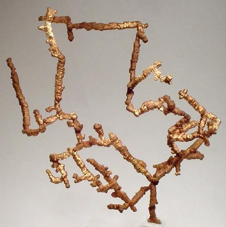
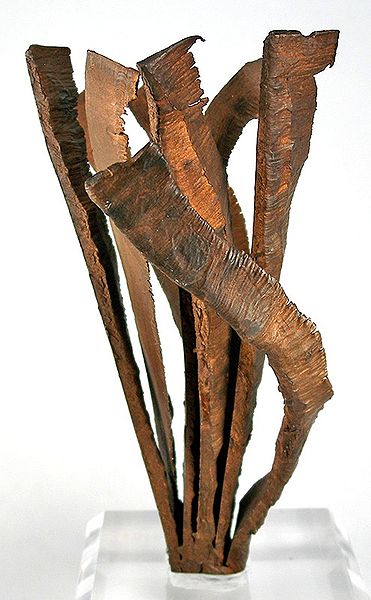
Spectacular specimen of elongated, spinel-twinned copper crystals from the old White Pine mine.

copper, copper mining in michigan, mining in michigan, copper mining, Quincy Mines, Keenewa, Calumet

The copper-bearing Nonesuch Shale at the south end of the Copper Country in Ontonagon County had been known since the 1800s. But the ore grades were too low, the ore mineral particles too small, and the copper was largely in sulfides instead of native copper. All these conditions made the shale deposits uneconomical, although repeated attempts were made to mine the shale at the Nonesuch mine.
In 1955 the Copper Range Company began large-scale mining at the White Pine mine, near the old Nonesuch mine. The deposit is a stratiform deposit in the lower 15 m of the Proterozoic Nonesuch Shale and the upper 2 m of the underlying Copper Harbor Conglomerate. The principal ore mineral was chalcocite, although native copper predominated in the lower part of the beds. The mine was very successful, producing more than 1.8 million metric tons of copper during its life. The White Pine mine, the last major copper mine in Michigan, shut down in 1995.
The company applied to government agencies to continue mining by in-situ leaching, using sulfuric acid to recover an additional 900 million pounds of copper by SX-EW. The Michigan Department of Environmental Quality approved the permit in May 1996, and White Pine installed a pilot in-situ leaching project.[1] Native Americans of the Bad River Indian Reservation in northern Wisconsin blockaded rail shipments of sulfuric acid to the mine (see Bad River Train Blockade); the mine began receiving acid shipments by truck. The U.S. Environmental Protection Agency (EPA), which had previously held that it had no role in the permitting, reversed itself, and stated that White Pine would have to apply for a federal permit. White Pine, which had already started to recover copper from the pilot project, suspended solution mining in October 1996, and applied for to the EPA for the permit.[2] In May 1997 the company withdrew the EPA permit application, saying that further permitting delays had made the project uneconomical, and announced plans to begin reclamation of the mine site.
The tailings impoundment at the White Pine Mine is presently the site of significant environmental degradation. The University of Montana undertook extensive efforts to restore and revegetate the barren landscape from 1997-1999, but it is unclear whether this has been successful. The university has published a detailed report of its project.[3] Satellite images are available at (46°47′17.91″N 89°31′47.97″W).
In 2012, SubTerra used the mine for pharmaceutical research.[11]

Copper heritage

The Keweenaw Peninsula is the site of the most extensive known deposits of native copper in the world. Occurring here in relatively pure form, the red metal could be broken out of the rock and worked to make a wide variety of products, from jewelry and tools by its earliest miners to coins and electric wire by its final generations. Keweenaw copper was mined for approximately 7,000 years, from 5000 BCE until 1968. During the period for which records were kept, 1840–1968, more than 11 billion pounds (5 million metric tons) of copper were mined here. During the peak production years of World War I, 1916–1917, the annual copper yield reached a maximum of 270 million pounds (125,000 t).

copper, copper mining in michigan, mining in michigan, copper mining, Quincy Mines, Keenewa, Calumet

"(7) The entire picture of copper mining on Michigan's Keweenaw Peninsula is best represented by three components: the Village of Calumet, the former Calumet and Hecla Mining Company properties (including the Osceola #13 mine complex), and the former Quincy Mining Company properties. The Village of Calumet best represents the social, ethnic and commercial themes. Extant Calumet and Hecla buildings best depict corporate paternalism and power, and the themes of extraction and processing are best represented by extant structures of the Quincy Mining Company."[2]

Ethnic heritage

Two ethnic groups, the Cornish and the Finns, are especially important in the heritage of the Keweenaw National Historical Park. When news of the region's rich native copper was first widely published in the 1830s, many families from the English county of Cornwall immigrated to the Upper Peninsula, bringing the Cornish pasty and their region's knowledge of hard-rock mining with them. Several park Heritage Sites, including the log cabin village of "Old Victoria," recall Cornish heritage in the region.
Later in the 1800s, many families from Finland emigrated to the United States. Until 1918, Finland was a colony of Russia. A large percentage of these Finns settled in the Western Upper Peninsula because of perceived similarities between their old and new homes, and found work in the Keweenaw. Finnish saunas can still be found throughout the area. Several park Heritage Sites, including the "Hanka Homestead", recall the Finnish influx.

Calumet Unit

The Calumet Unit of the Keweenaw National Historical Park includes many sites in and around the villages of Calumet and Laurium, which are not ghost towns but operating human communities that have survived the shutdown of their parent employer, the Calumet and Hecla Mining Company, in 1968. By digging shafts into the rock, the men and owners of the Calumet & Hecla found geological formations of rock laced with nuggets of almost pure copper.
The Calumet & Hecla was the richest of the separate copper mines of the Keweenaw, and the towns built at the mine head reflect its productivity. A 1,200-seat opera house, large churches built of Lake Superior brownstone, and mansions built by the mining bosses survive as memories of the Calumet mine's glory years.
Copper Mining Quincy Copper, Mining in MI, Copper Mining, Michigan History, Michigan, Mines for copper, drawnings
Main Office of the Calumet and Hecla Mining Company (now the Headquarters of the National Historical Park)
The Company Library and Bathhouse for its employees.
Warehouse of the C&H Mining Company in Calumet, Michigan.

Quincy Unit

Main article: Quincy Mine
http://bits.wikimedia.org/static-1.20wmf8/skins/common/images/magnify-clip.png
Quincy Unit, Keweenaw National Historical Park

copper, copper mining in michigan, mining in michigan, copper mining, Quincy Mines, Keenewa, Calumet

The Quincy Unit of the Keweenaw National Historical Park commemorates one of the most remarkable feats of engineering in northern Michigan, the 9,000-foot (2,700 m) deep Quincy Mine shaft. Nicknamed "Old Reliable" for its record of paying annual dividends for decades, the Quincy mine enjoyed a position on the rich copper rock of the Pewabic Lode. A private preservation foundation maintains the Quincy Mine's surface mine hoist, which is the largest steam-powered hoist in the world.
Copper Mining Quincy Copper, Mining in MI, Copper Mining, Michigan History, Michigan, Mines for copper, drawnings
Quincy Mine plan created by the HAER, National Park Service, Department of the Interior.
Copper Mining Quincy Copper, Mining in MI, Copper Mining, Michigan History, Michigan, Mines for copper, drawnings
Quincy Smelting Works plan created by the HAER, National Park Service, Department of the Interior.
Copper Mining Quincy Copper, Mining in MI, Copper Mining, Michigan History, Michigan, Mines for copper, drawnings
Mine Hoist Powerhouse for the Quincy Mine Hoist.

Heritage Sites

As of 2009, the Keweenaw National Historical Park operated in cooperation with 16 heritage sites in the Keweenaw Peninsula and nearby.[3]

Adventure Mining Company

The Adventure Mining Company is located at 200 Adventure Avenue in Greenland, Michigan.[3] The Adventure Mine operated in Greenland from 1850 until 1920, and consisted of five shafts, one of which descended 1,300 feet (400 m) beneath the surface.[4] Although the site seemed promising, the mine never turned a profit.[4] The Adventure Mining Company currently offers offers tours of the surface and underground portions of the Adventure Mine.[3]

A.E. Seaman Mineral Museum

The A.E. Seaman Mineral Museum was located on the Fifth Floor of Electrical Resource Center at Michigan Technological University in Houghton, Michigan.[3] As of 2011, it is now located across from the Advanced Technology Development Complex.[5] The museum is named for Arthur Edmund Seaman, who worked at Michigan Tech in the late 19th and early 20th centuries, and was the museum's curator from 1928-1937.[6]
The mineral collection was established in the 19th century, and by 1890 numbered 27,000 specimens.[6] A museum to house the collection was constructed in 1908.[6] The museum has since moved several times, and the collection has grown to over 30,000 specimens, of which 8000 are on display.[7] The museum features an extensive mineral collection and exhibits on copper formation,[3] and has the world's best collection of crystallized native copper and native copper in crystallized calcite.”

Happy Ancestor Hunting!