Haldimand County Museum & Archives (Cayuga, Ontario)
From Wikipedia, the free encyclopedia
The Haldimand County Museum & Archives, located at 8 Echo Street in Cayuga, Ontario,Canada, is a museum that preserves and makes accessible evidence of the history ofHaldimand County. Artifacts related to Haldimand County, from its precivilization[citation needed]beginnings to the 20th century, are restored and displayed in the museum galleries and grounds. The current curator is Karen Richardson.
.JPG/450px-Aboriginal_War_Veterans_monument_(close).JPG)
First Nation War Memorial in Canada
From: Wikipedia see link
Haldimand County
From Wikipedia, the free encyclopedia
Haldimand is a rural city-status single-tier municipality (but called a county) on the
Niagara Peninsula inSouthern Ontario, Canada, on the north shore of Lake Erie, and on the Grand River.
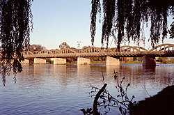
Municipal offices are located in Cayuga.
History
Haldimand's history has been closely associated
with that of the neighbouring Norfolk County.
Haldimand was first created as a county in 1800, from a portion of Norfolk.
It was
named after the governor of theProvince of Quebec Sir Frederick Haldimand.
In 1844 the land was surrendered by Six Nations
to the Crown in an agreement that was
signed by the vast majority of Chiefs in the
Haldimand tract[citation needed].
The two
counties were separate until 1974, when they were reunited as the
In 2001, the counties were separated again, but
the lower-tier municipalities
from the former Haldimand-Norfolk were merged
into two single-tier
municipalities.
Although
they both retained the name "county" for historical reasons, each is
governed
as a single municipality without lower-tier governments.
Haldimand was formed through the amalgamation of
the former
Towns of Haldimand and Dunnville, and the
eastern half of the City of Nanticoke.
Beginning in February 2006, a land dispute by native
protesters began near Caledonia over a
housing development being built on the
outskirts of town,
which members of the nearby Mohawk Six Nations
people claim is rightfully their land.
Communities
The main towns in Haldimand are Jarvis, Hagersville, Caledonia, Cayuga and Dunnville.
Part of
the Six Nations
Reserve is in Haldimand County,
but not within its jurisdiction.
Most of
Haldimand is agricultural land, although some heavy industry, including
the Nanticoke Generating
Station, is located here.
Smaller communities within the municipality are
Attercliffe Station, Balmoral,
Bodri
Bay, Brookers Bay, Byng, Canborough, Canfield, Cheapside, Clanbrassil,
Crescent
Bay, Decewsville, Empire Corners, Featherstone Point, Fisherville, Garnet,
Hoover Point, Kohler, Little Buffalo, Lowbanks,
Moulton, Mount Carmel, Mount Healy,
Nanticoke, Nelles Corners,
Peacock Point, Port Maitland,
Rainham Centre, Selkirk,
Sims Lock, South Cayuga, Springvale, Stromness,
Sweets Corners, Townsend,
Willow
Grove, Woodlawn Park and York.
The ghost towns of Cranston, Dufferin, Erie, Indiana Lambs Corners, Lythmore,
Sandusk, Upper, Varency, are also located within
Haldimand.
Historic townships
Haldimand County area 284,817 acres (1,153 km2)
was formed from part of the land grant to the Six Nations in 1783. The County was
purchased by treaty and opened for general settlement in 1832. It was first
settled by white veterans of Butler's Rangers established there by Joseph Brant. A large
number of Germans were among the first settlers.
·
Canborough, area 21,586 acres (87 km2).
Granted in 1794 by Joseph Brant to John Dochstader of Butler's Rangers.
Purchased by Benjamin Canby in 1810 for 5,000, he named the village-site
"Canborough. Community centre: Canborough, Darling and it touches
Dunnville
·
Dunn, area 15,122 acres (61 km2).
Opened for settlement in 1833. Community centre: Dunnville
·
Moulton, area 27,781 acres (112 km2).
Landowner Henry John Boulton named the township from the Boulton family seat in
England.
·
North
Cayuga, area 32,825 acres
(133 km2).
·
Oneida, area 32,598 acres (132 km2).
Joseph Brant granted a 999 year lease of part of Oneida and Seneca townships to
Henry Nelles, of Butler's Rangers and his sons, Robert, Abraham, William,
Warner and John. Community centres were: Caledonia, Dufferin and Hagersville.
·
Rainham, area 25,705 acres (104 km2)
Community centres: Balmoral, Selkirk, Rainham Centre and Fisherville.
·
Seneca, area 41,721 acres (169 km2).
Community centres: York and Caledonia
·
Sherbrooke, area 5,098 acres (21 km2), the
smallest township in Ontario. Opened in 1825 and named from Sir John Coape Sherbrooke,
a Governor-General of Canada. The Township was granted by the Indians to William Dickson (a lawyer) as a professional fee. Community
centres: Stromness and Port Maitland.
·
South
Cayuga, area 13,293 acres
(54 km2). Community centre: Cayuga
·
Walpole, area 66,213 acres (268 km2).
Community centres were: Hagersville, Jarvis, Selkirk, Cheapside and Nanticoke.
Source: Province of Ontario -- A
History 1615 to 1927 by Jesse Edgar Middleton
& Fred Landon, copyright 1927, Dominion Publishing Company, Toronto
No comments:
Post a Comment